Tag: technology

Tolkien and the Ridgeway – Part 2

If you missed it you can read Part 1, on the stretch from Tring to Wendover, including Boddington Fort.

Tolkien’s Country
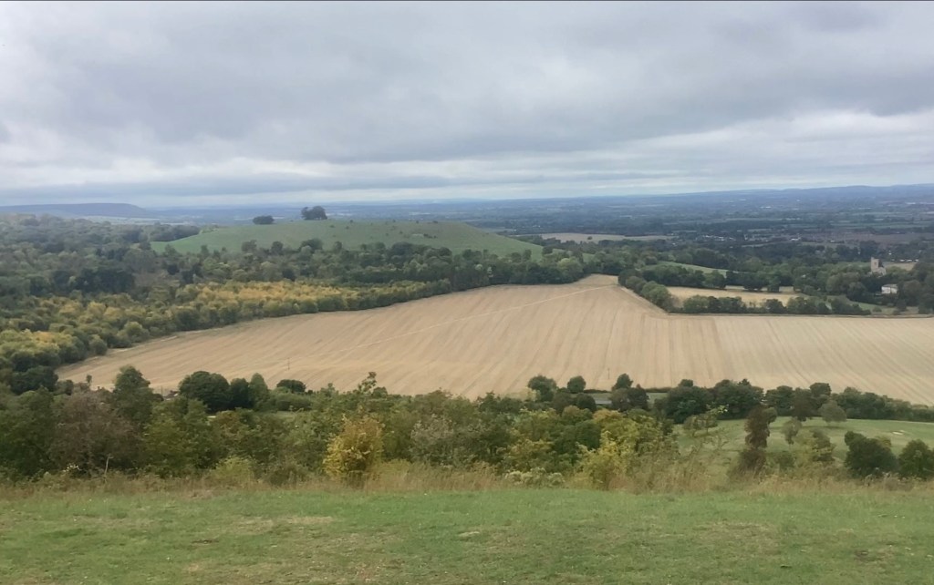
View toward Wendover from Coombe Hill War Memorial

Tolkien lived and taught in Oxford for many years, so many ancient sites in Oxfordshire and surrounding counties, including Hertfordshire and Buckinghamshire, would have been well within reach for a day out. Boddington Fort strongly resembles the Old Forest topographically in The Fellowship of the Ring, so you can read about this in more detail using the link above.

Beleriand

Beleriand sank beneath the sea in The Silmarillion, somewhat analogous to the sinking of Doggerland, an event that shaped ancient Britain and kickstarted the popular route of The Ridgeway 7000 years ago. To find out more, read on.

The Sinking of Doggerland and rise of The Ridgeway

To understand Britain before The Great Ridgeway (which includes the Icknield way north of Ivinghoe Beacon), we must understand two things.
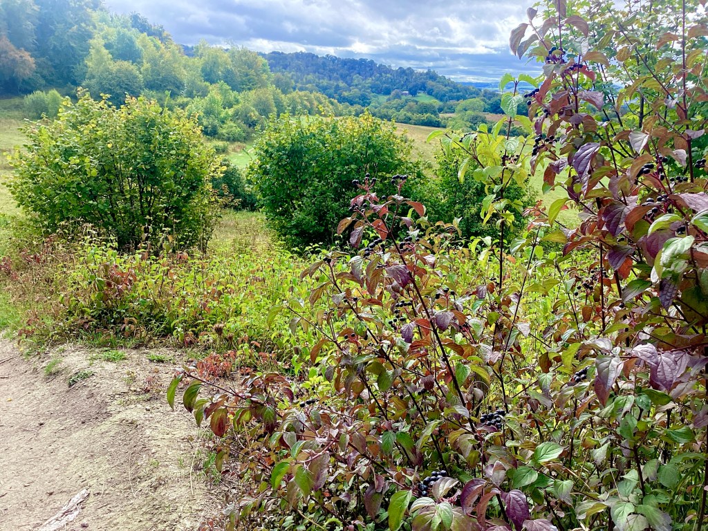
Grangelands and Pulpit Hill Nature Reserve chalk slope

First, Britain wasn’t yet an island but was connected to Europe by a landbridge we now call Doggerland. The name lingers on in Dogger Bank, an enormous sandbank below the waves that presents a danger to fishermen.

The second is that there is a popular idea that Britain’s population 10,000 years ago consisted of tribes constantly at war. A more accurate model is of tribes interacting in trade and worship, with annual pilgrimages every year to the most popular ceremonial sites on the South Coast in Dorset, where sites like Avebury and Stonehenge still survive today. Popular trade goods would have been Welsh gold, Cornish tin and luxury goods from Europe arriving via ports in Norfolk on the East Coast, not far north of London today. In fact, in those days, the River Thames connected with the Rhine system, where they both drained south as what we now call the English Channel.
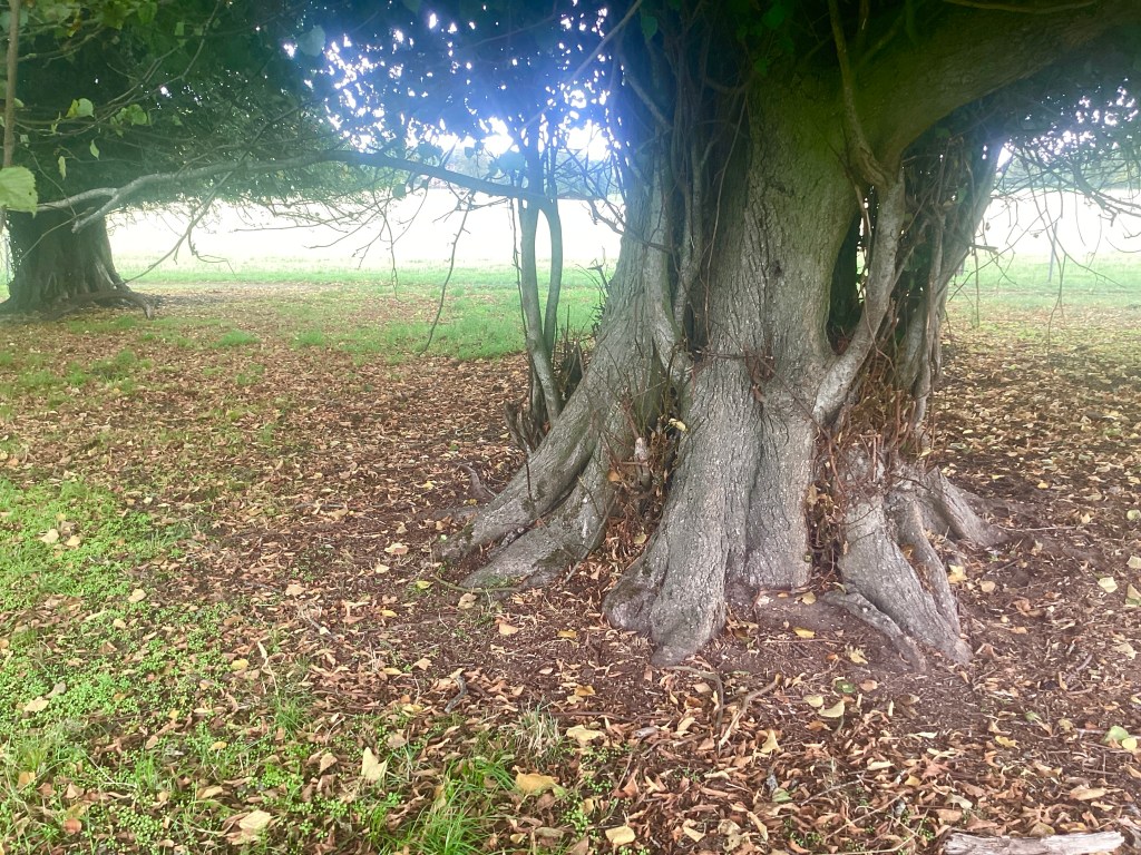
You can just see Chequers, the Prime Minister’s hideaway, above the horizontal branch. I took another shot of the open field and group of trees, but there are too many beautiful shots to post them all!

But approximately 8150 years ago, a great landslide in Norway caused a tidal wave that waterlogged Doggerland, making it probably very difficult to negotiate. Futhermore, the rising sea levels after the last Ice Age that had already been progressively inundating Doggerland finally sank it beneath the waves over the next 1000 years. Now Britain was an island.

The Great Ridgeway, a track that wound its way along a chalk ridge southeast from Norfolk to the great ceremonial sites in Dorset, was probably already in use and possibly continued further north. But with the sinking of Doggerland, trade arrived in Norfolk ports, so about 7000 years ago, the Great Ridgeway probably became the ideal route south.

Why Walk Along a Ridge?
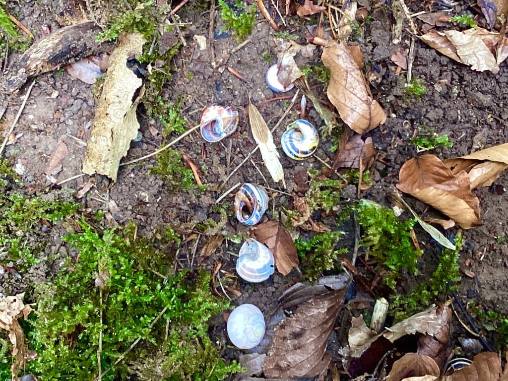
Grove snail shells in Grangelands and Pulpit Hill Nature Reserve. These woods are famous for orchids, but not in September.

The truth is more complex than one answer. Walking along a chalk ridge usually means well-drained ground and less trees to negotiate, England being heavily forested at the time. It also gives greater views of the route forward and makes it harder for robbers to ambush travellers. But you’re probably thinking walking in hills is unwise. Actually, counterintuitive though it may be, the highest ridge, with less up and down inclines, can be the easiest route, when the whole landcape is crisscrossed by valleys.

A Last Thought

You could argue that The Ridgeway offered a model to Tolkien for the Great South Road (The Greenway). That’s something to think about when you walk it.
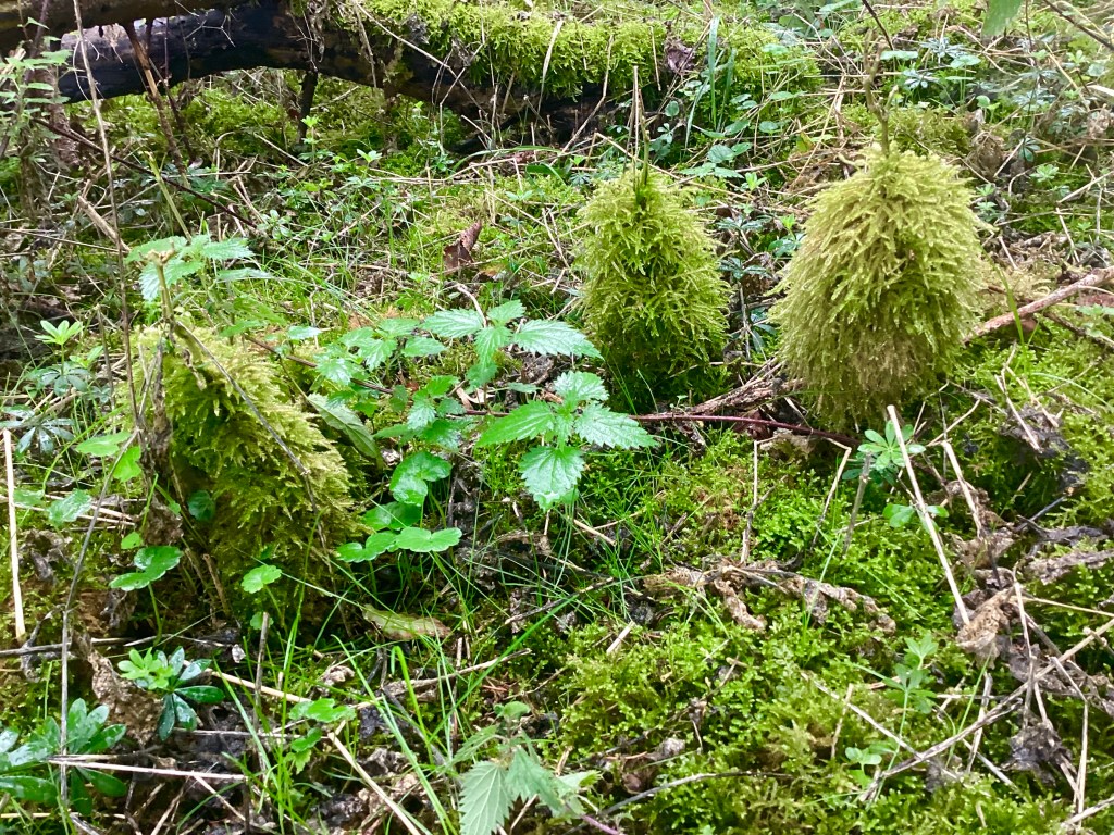
Rough-stalked Feather-moss growing on beech saplings

How the Web Was Won: Part 1 – Discovery

Note: The names of people are probably aliases.

Studying aeronautical engineering at Queen Mary College in 1982 exposed me to programming using BASIC, but it was cumbersome. After a diploma and short career in Graphics, followed by a period in the music industry, I trained on desktop computers and contracted using QuarkXpress, PageMaker, Adobe Illustrator and Adobe Photoshop for companies like BT and Dorling Kindersley.

I arrived at Nortel on a short-term contract as a desktop publishing specialist, where I had to quickly learn Aldus FreeHand. My job was mainly visual: producing brochures, manuals and technical illustrations. Over time I became the person who produced many of the illustrations for their satellite and fibre optic equipment. Some of the diagrams were enormous by the standards of the time — complex FreeHand files with well over a hundred layers, sometimes requiring two people simply to manage the separation of the artwork.

Software testing at 5 am.

I understood the communications technology visually long before I understood it technically.

The moment that changed everything came in late 1994. I was called into the office of one of the senior engineers, waiting for a photograph of a modified satellite component. While I was watching his computer screen, I noticed a small animated dog running across it. At the time, seeing animation on a computer was unusual enough that I asked what it was.

He explained that it was called Fetch. Fetch was an FTP client — File Transfer Protocol — and he explained that it was being used to transfer files over something called the Internet.

At that moment I thought I was discovering the Internet, although what I was really discovering was one small part of what would become the World Wide Web. The distinction wasn’t obvious at the time. To many of us, the Internet and the Web were the same mysterious new thing, but everybody had been talking about it, and I hadn’t noticed. 

When I had mastered the illustration packages and other departments came knocking, even my dour, pony-tailed teacher seemed impressed. But a female colleague who was used to claiming all the men’s ties at the Christmas Party didn’t get mine! Even at a conservative company like Nortel, there were rebels.

I left Nortel in early 1995, but I was curious. I discovered that Holloway Library in North London had one of the few public internet terminals available locally. I booked regular sessions on it, often finding that I was the only person in the booking diary.

The process was far from simple. There was a thick folder of instructions, and connecting involved a 14.4 kbps modem and several pages of steps. It could take around twenty minutes just to get online.

When I finally connected, the Web was a very different place from what we know today. Most pages were simply text: black letters on a white background, occasionally white text on black. Images were rare.

Then I discovered websites that contained actual pictures.

One of the first memorable examples was Caltech, where I found crude colour bitmap images showing things like tidal charts and photographs of the coastline. I also visited NASA, which seemed like the obvious destination for someone fascinated by technology and space. Seeing those first images appear over a slow modem connection was astonishing. They were technically unimpressive by modern standards, but at the time they felt like a glimpse of the future.

That was when I decided I needed to learn how this new medium actually worked.

Part 2

You can always find a full index of all the articles on the page under About me in the main menu.